| The American Revolution - The Southern Campaign |
|
The following land plat was created while the 1858 covered bridge was still in use over Dan River at South Boston and the ferry location was still common knowledge. Because the stone support columns for the bridge have never been removed they were recently used as the reference point for locating the ferry landing on the north side of the river. Notice the river depot. This was used to transfer batteau cargo, presumably tobacco, to the Richmond & Danville R.R. which was completed to South Boston in 1854. 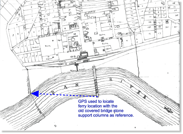
This is an early plat of where the Boyd's Ferry road was located south of the river and east of Lawson Creek. This plat was researched and contributed by Faye Royster Tuck and was published in her book "Yesterday - Gone Forever". 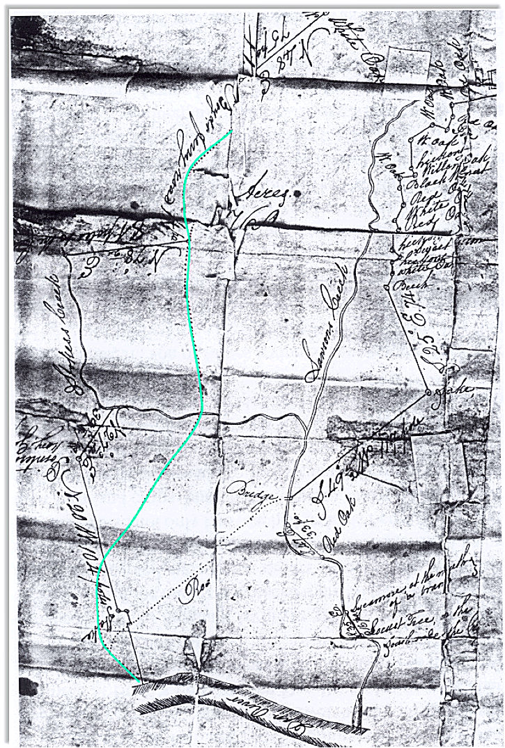 |